Explore Map
From the coast
to your corner of it.
Find Marbella in Guanacaste. Then take a closer look at Costa Dorada.
01 · Geographic context
A place between
familiar names.
Marbella lies along the Guanacaste coast between Tamarindo and Nosara, with Santa Cruz inland and Liberia farther north.
Pan and zoom to explore. Cartography © OpenStreetMap contributors. The pin marks Marbella town, not Costa Dorada’s entrance or boundaries. Open a larger regional map ↗
02 · Costa Dorada development reference
Costa Dorada.
Then a closer look.
Start with the full Costa Dorada planning-area overview. Then explore Las Colinas, the first planning area with sections A, B, and C, and finally the closer Phase A view.
These are the team-supplied plan illustrations, not a survey, confirmed current build status, or availability map. Labels for the Village, boutique hotel, and other planned features describe concepts, not completed or guaranteed amenities. Current boundaries, lot configurations, approvals, and status require confirmation.
Costa Dorada · Full planning-area overview
The wider Costa Dorada plan extends inland beyond Las Colinas. This supplied overview places the first planning area within the larger landscape, alongside the other labeled planning areas and green zone.
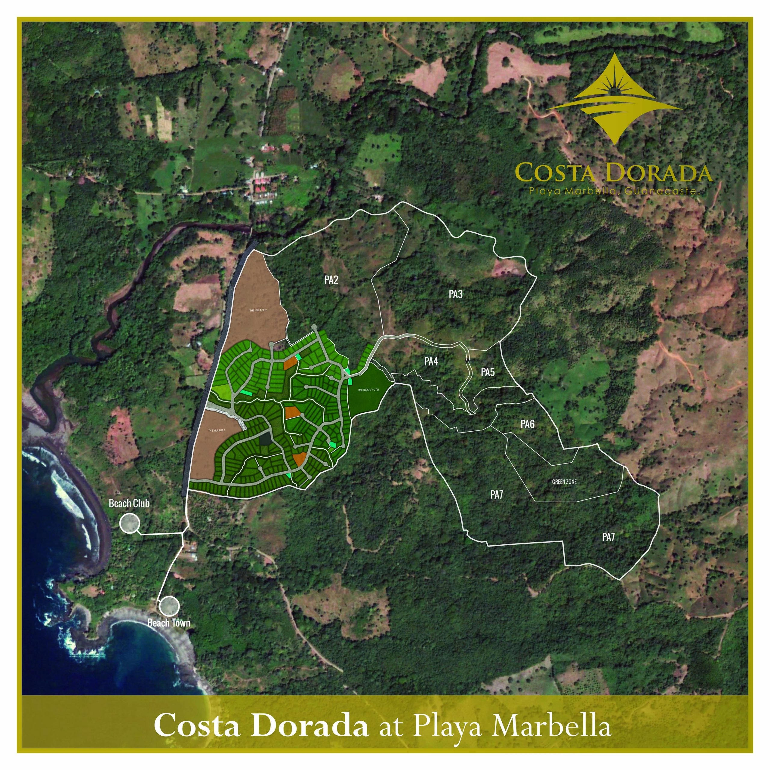
Source: full Costa Dorada overview supplied by the project team. Original labels retained; planned uses do not establish current amenities or availability. Open full-resolution Costa Dorada plan ↗
Las Colinas · A / B / C
Las Colinas is the first planning area within Costa Dorada. Sections A, B, and C belong to Las Colinas; they do not represent the full Costa Dorada development.
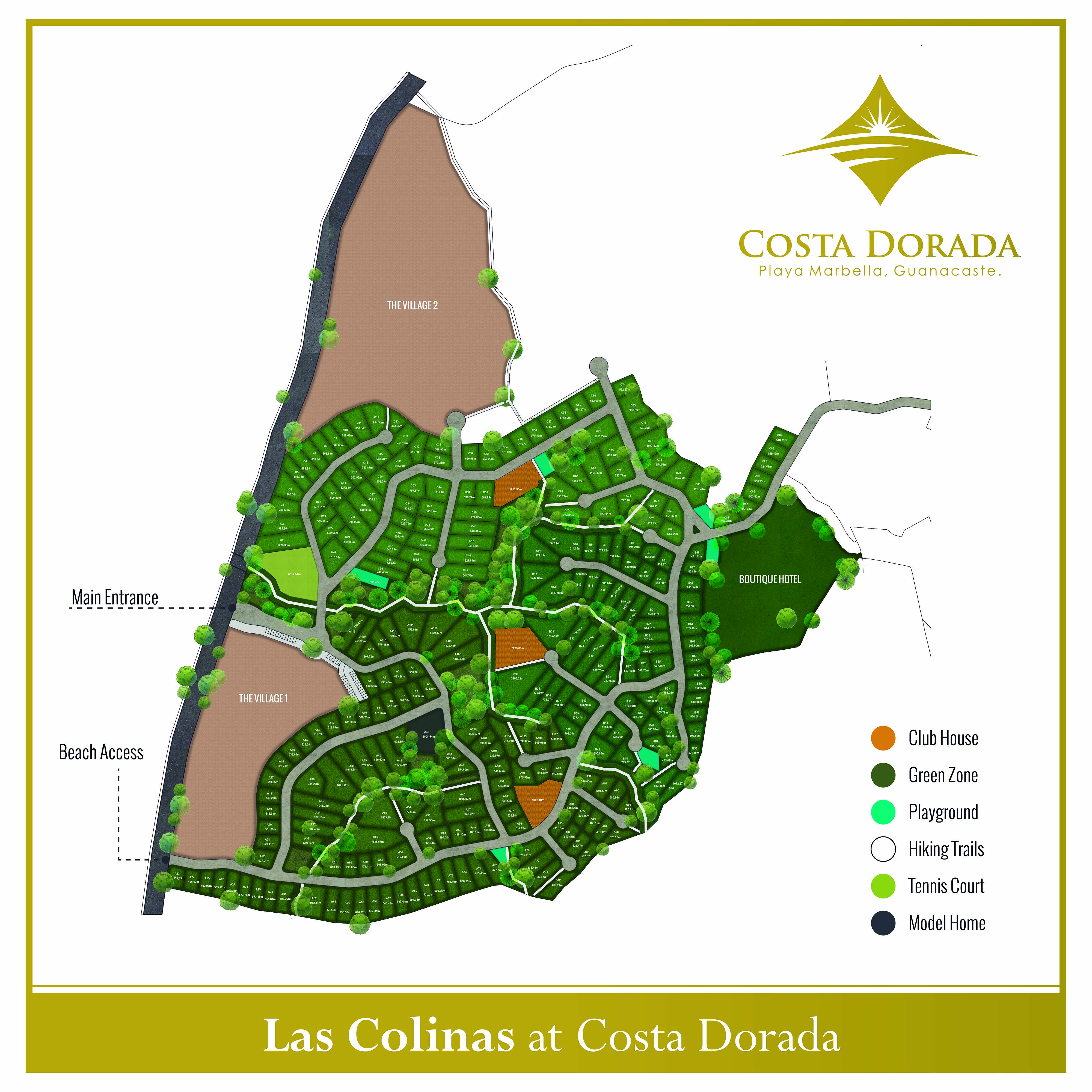
Source: Las Colinas plan supplied by the project team. Original labels preserved. Open full-resolution Las Colinas plan ↗
Las Colinas · Phase A
The closer view includes the brochure’s lot identifiers, road layout, Oceanside direction, South Entrance, and a conceptual Village area. No lot is selectable or represented as available here.
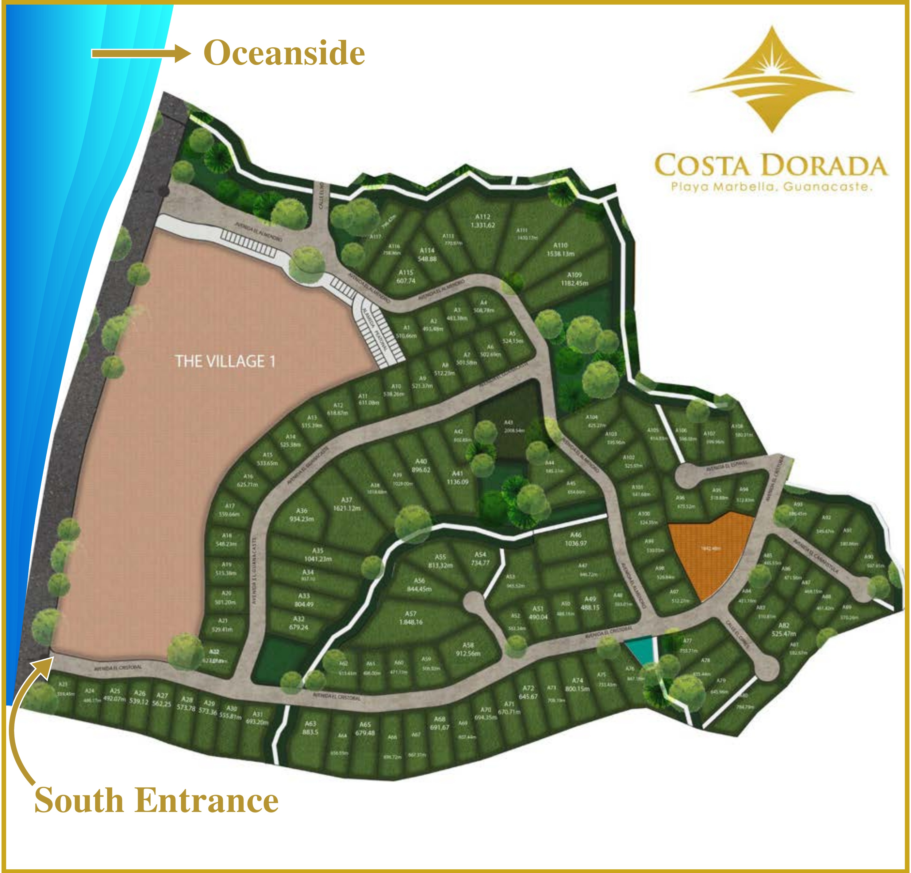
Source: supplied Sales Costa Dorada Brochure 2026, page 8, lower illustration. Open full-resolution Phase A plan ↗ · View complete source page ↗
03 · Current property information
Found something
you want to understand?
Tell us the lot identifier or part of the plan that interests you. We will confirm the current configuration, availability, price, services, and what is planned nearby.
The team’s live interactive map remains a separate workstream. These reference plans give you a clearer way to begin the conversation today.
Ask about a property